Geography of Mauritius
Mauritius, located in the southern hemisphere in the Indian Ocean, is geographically part of the continent of Africa. To the east of Madagascar and La Reunion, it is north of the tropic of the Capricorn, 20° South Latitude and 57° Longitude East.
Mauritius is a republic, and the island consists of 91% of the total area of the Republic of Mauritius, covering 1 865 km². Its actual entire area is 2,040 km², and that includes several islands, islets, and dependent coral reefs, including Rodrigues Island (10th district of Mauritius).
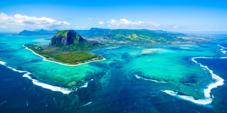
Mauritius has about 330 km of coast, surrounded by a clear turquoise lagoon, protected by coral reefs.
The Mascarene Archipelago
Mauritius forms part of the Mascarene archipelago which also includes La Reunion and Rodrigues. All islands resulted from underwater volcanic eruptions, although La Reunion is the only one still experiencing volcanic activity through its volcano 'Piton de la Fournaise', one of the most active volcanoes in the world. In Mauritius, there is a dormant volcano at Trou aux Cerfs.
Approximate distances from Mauritius:
- 226 km to Reunion Island
- 1,132 km to Madagascar
- 3,318 km to the East African coast
- 5, 110 km to India
- 7,722 km to Australia
- 7,941 km to China
- 9,400 km to France
Capital, cities, and villages
Port Louis, the capital city, was founded by the Governor Mahé de Labourdonnais. He developed the port so as to accommodate ships in a harbour that is sheltered by a mountain range.
Port-Louis is also home to the Government House, many businesses, financial institutions, and the main governmental institutions. It is the business hub of Mauritius and the city with the largest number of inhabitants. However, there are other main towns in Mauritius, such as Curepipe, Quatre-Bornes, Beau Bassin, Rose Hill, and Vacoas Phoenix. Ebene Cybercity is another major business hub, with many big companies and offices found there.
The island is divided into ten districts:
- Black River
- Flacq
- Grand Port
- Moka
- Pamplemousses
- Plaines Wilhems
- Port Louis
- Rivière du Rempart
- Savanne
- Rodrigues
Nine of these are found on the main island of Mauritius. The tenth district is Rodrigues Island, which is a smaller island and a dependency of the Republic of Mauritius, and is located approximately 550 km northeast of Mauritius. Rodrigues is an autonomous state, since 12th October 2002.